Brief Analysis on Application Advantages of UAV Surveying and Mapping Technology in Open-Pit Mines
Abstract
UAV surveying and mapping technology, leveraging its efficiency, precision, and flexibility, demonstrates significant advantages in open-pit mine resource development, hazard prevention, and ecological restoration. This paper systematically reviews the evolution of UAV surveying and mapping technology, elaborates on its application workflow in open-pit mines, and summarizes nine core advantages. Concurrently, it analyzes challenges including environmental constraints, data processing bottlenecks, and regulatory gaps. Future directions are proposed across three dimensions: technological breakthroughs, application expansion, and cross-sector collaboration. By establishing a dynamic equilibrium mechanism for exploration-extraction-reclamation, UAV surveying catalyzes digital and intelligent transformation in open-pit mining, delivering innovative solutions for sustainable mineral industry development.
References
[2] Gao, J. (2012). Application of tilt photogrammetry in smart city construction. Heilongjiang Science, 13(06), 91–93.
[3] Jiang, Y., Zhao, P., & Ma, X. (2020). Algorithm for rapid screening UAV effective aerial images. Engineering of Surveying and Mapping, 29(01), 37–40+46.
[4] Hu, X. (2012). Application of network RTK survey photo control points in Yangwu Reservoir Surveying and Mapping Project. Forum of Association for Science and Technology (Second half of the Month), (04), 88–89.
[5] Yi, Y., Li, Y., & Ren, M. (2009). Discussion on the method of highway strip topographic mapping. Jiangxi Surveying and Mapping, (02), 38–40.
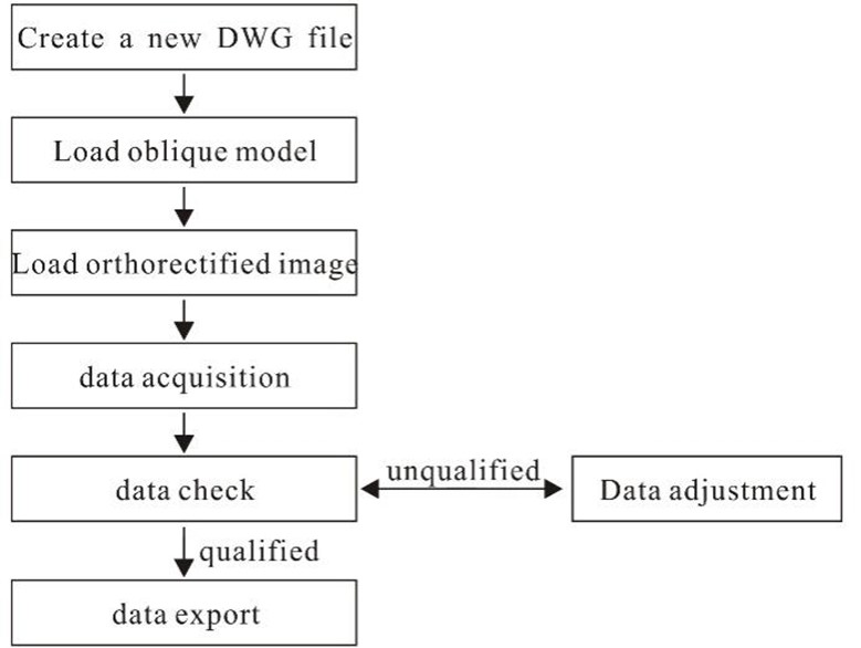
[6] Zhu, J. (2019). Production practice of 1∶2000 DLG data based on UAV aerial survey. Beijing Surveying and Mapping, 33(03), 314–317.
[7] Li, W., & Huang, Y. (2020). Application of GNSS PPK technology in dredging and filling engineering projects. Port Engineering Technology, 57(05), 112–115.

This work is licensed under a Creative Commons Attribution 4.0 International License.
Copyright for this article is retained by the author(s), with first publication rights granted to the journal.
This is an open-access article distributed under the terms and conditions of the Creative Commons Attribution license (http://creativecommons.org/licenses/by/4.0/).


1.png)